


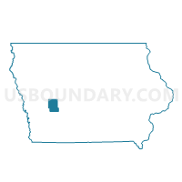
LEROY TWP Voting District, Audubon County, Iowa
About
Outline

Summary
| Unique Area Identifier | 581415 |
| Name | LEROY TWP Voting District |
| County | Audubon County |
| State | Iowa |
| Area (square miles) | 36.85 |
| Land Area (square miles) | 36.85 |
| Water Area (square miles) | 0.00 |
| % of Land Area | 100.00 |
| % of Water Area | 0.00 |
| Latitude of the Internal Point | 41.73240940 |
| Longtitude of the Internal Point | -94.91819290 |
Maps


Graphs
Select a template below for downloading or customizing gragh for LEROY TWP Voting District, Audubon County, Iowa


Neighbors
Neighoring Voting District (by Name) Neighboring Voting District on the Map
- CAMERON TWP Voting District, Audubon County, IA
- DOUGLAS TWP Voting District, Audubon County, IA
- GREELEY TWP Voting District, Audubon County, IA
- HAMLIN TWP Voting District, Audubon County, IA
- LINCOLN TWP W/O GRAY Voting District, Audubon County, IA
- MELVILLE TWP Voting District, Audubon County, IA
- SHARON TWP Voting District, Audubon County, IA
- VIOLA TWP Voting District, Audubon County, IA
Top 10 Neighboring County Subdivision (by Population) Neighboring County Subdivision on the Map
- Leroy township, Audubon County, IA (2,496)
- Sharon township, Audubon County, IA (584)
- Lincoln township, Audubon County, IA (285)
- Hamlin township, Audubon County, IA (252)
- Douglas township, Audubon County, IA (210)
- Greeley township, Audubon County, IA (170)
- Viola township, Audubon County, IA (166)
- Cameron township, Audubon County, IA (135)
- Melville township, Audubon County, IA (117)